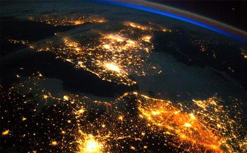
Satellite photos of Earth haven't been a novelty for a while, but a new PBS series suggests that fact shouldn't diminish their wonder.
Life From Above, a multipart series that premieres Wednesday at 10 p.m. ET on PBS (check local listings), combines remarkable satellite images with ground-level photography of the same scenes to illustrate the visual and often scientific value of a sweeping top-down perspective on large-scale phenomena.
The opening scene of the opening episode, while not an obvious marquee moment, illustrates the premise.
The event is a parade drill at a kung fu academy in Dengfeng, China, where 13-year-olds train in the discipline of that martial art.
The drill brings thousands of students into an enclosure where they show off their synchronized movements.
At ground level, it's an impressive display that resembles a military exercise. From above, however, the viewer sees how those students, each in a bright red uniform set off against the white ground, are creating remarkable images and patterns.
If Busby Berkeley had been a practitioner of kung fu, this is what movies like 42nd Street might have looked like. From the satellite, we get the full impact of the Dengfeng choreography. You wish people on the ground could see it, too.
From there, the first episode moves around to track an elephant herd and then scan the Suez Canal, the 12-mile man-made waterway that shaved 4,000 miles off the sea voyage from Europe to Asia.
Subsequent episodes focus on other themes, including the colors of the planet and the patterns of what we inherit and create.
The colors episode swings from great sweeping mountains and oceans to relative specks that nonetheless speak to our spirit.
A man in Chennai, India, puts out 50 pounds of rice every day for a flock of wild parakeets that has grown to around 4,000.
Every day for 15 years, he has risen at 5 a.m. to prepare for the birds' breakfast. In a city that's generally as grey as most other cities in the world, he has made his rooftop a splash of bright green.
As this suggests, Life From Above goes beyond pretty pictures to explain the meaning and value of those pictures.
One remarkable satellite image tracks a cloud of orange dust from its pickup by winds in the Sahara Desert to a trans-Atlantic crossing to its ultimate landing, via rainfall, in the tropical forests of South and Central America.
This sort of tracking helps scientists better understand the physical forces at work on the planet. It helps them monitor the freezing and thawing of lakes within Arctic glaciers, as well as extreme weather systems like hurricanes.
Satellite images couldn't prevent the destruction from Hurricane Harvey. They did enable scientists and responders to better track its precise movements.
On a less somber note, Life From Above follows civilian scientists who sent a balloon 90,000 feet above Earth to follow the trajectory of the 2017 total solar eclipses over North America.
The photos of its shadow traversing the continent are extraordinary.
Life From Above joins other big nature series like Blue Planet as a fascinating and joyful celebration of our world.